
龙泉镇 topographic map
Interactive map
Click on the map to display elevation.
About this map
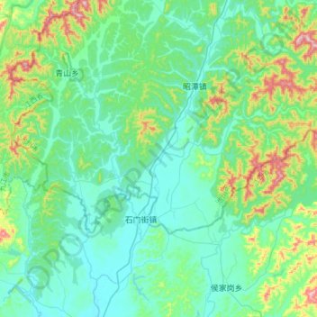
Name: 龙泉镇 topographic map, elevation, terrain.
Location: 龙泉镇, 东至县, 池州市, 安徽省, 247200, 中国 (29.56507 116.67392 29.68831 116.97213)
Average elevation: 308 ft
Minimum elevation: 52 ft
Maximum elevation: 1,329 ft
Other topographic maps
Click on a map to view its topography, its elevation and its terrain.