
桥西区 topographic map
Interactive map
Click on the map to display elevation.
About this map
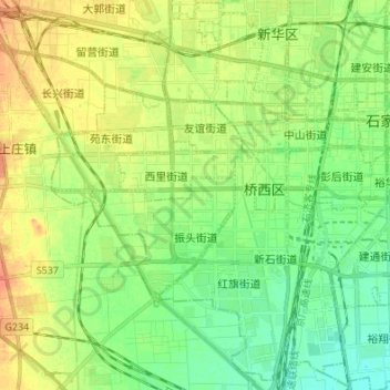
Name: 桥西区 topographic map, elevation, terrain.
Location: 桥西区, 石家庄市, 河北省, 050011, 中国 (37.97151 114.37066 38.07266 114.50621)
Average elevation: 262 ft
Minimum elevation: 210 ft
Maximum elevation: 325 ft
Other topographic maps
Click on a map to view its topography, its elevation and its terrain.