
黄北坪乡 topographic map
Interactive map
Click on the map to display elevation.
About this map
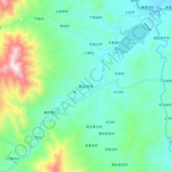
Name: 黄北坪乡 topographic map, elevation, terrain.
Location: 黄北坪乡, 石家庄市, 河北省, 中国 (37.56026 114.14093 37.64026 114.22093)
Average elevation: 1,532 ft
Minimum elevation: 794 ft
Maximum elevation: 3,950 ft
Other topographic maps
Click on a map to view its topography, its elevation and its terrain.