
秀林镇 topographic map
Interactive map
Click on the map to display elevation.
About this map
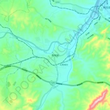
Name: 秀林镇 topographic map, elevation, terrain.
Location: 秀林镇, 石家庄市, 河北省, 中国 (37.95786 114.04757 38.03786 114.12757)
Average elevation: 961 ft
Minimum elevation: 679 ft
Maximum elevation: 1,932 ft
Other topographic maps
Click on a map to view its topography, its elevation and its terrain.