
Land topographic map
Click on the map to display elevation.
About this map
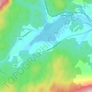
Name: Land topographic map, elevation, terrain.
Location: Land, Ringerike, Viken, 3534, Norway (60.21403 9.85431 60.25403 9.89431)
Average elevation: 709 ft
Minimum elevation: 453 ft
Maximum elevation: 1,529 ft
Other topographic maps
Click on a map to view its topography, its elevation and its terrain.