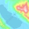
Lake Titicaca topographic map
Click on the map to display elevation.
Lake Titicaca
Lake Titicaca has a surface elevation of 3,812 m (12,507 ft). The "highest navigable lake" claim is generally considered to refer to commercial craft. Numerous smaller bodies of water around the world are at higher elevations. For many years, the largest vessel afloat on the lake was the 2,200-ton (2,425 U.S. tons), 79-metre (259 ft) SS Ollanta. Today, the largest vessel is most likely the similarly sized train barge/float Manco Capac, operated by PeruRail.
About this map
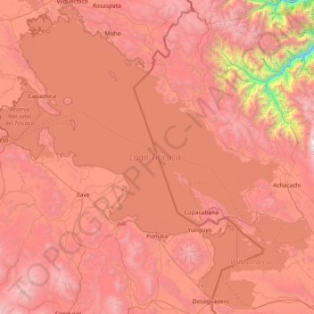
Name: Lake Titicaca topographic map, elevation, terrain.
Location: Lake Titicaca, Puno, Peru (-16.59816 -70.03591 -15.23333 -68.56834)
Average elevation: 12,697 ft
Minimum elevation: 4,685 ft
Maximum elevation: 19,019 ft
Other topographic maps
Click on a map to view its topography, its elevation and its terrain.

La Rinconada
High in the Andes, La Rinconada has an alpine tundra climate (ET, according to the Köppen climate classification), with no month having mean temperatures even close to the 10 °C (50 °F) threshold that would permit tree growth and a subtropical highland classification for the city. Far above the tree line,…
Average elevation: 16,152 ft

La Rinconada
The town has gained notoriety for its extreme living conditions that include its high rates of altitude sickness, pollution, poverty, murder, and sex trafficking, and as a result has sometimes been referred to in Spanish as la ciudad sin ley del Perú, which means "the lawless city of Peru".
Average elevation: 16,152 ft

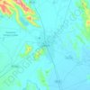
Juliaca
Juliaca is a large trade center for goods and services, and is considered the financial capital of the Puno region. Trade is its principal economic activity, comprising 26.5% of the Labor force. In 2008, Juliaca had 15,439 commercial establishments, which amounts to 41% of trade done in the Puno region. It is…
Average elevation: 12,667 ft
La Rinconada
High in the Andes, La Rinconada has an alpine tundra climate (ET, according to the Köppen climate classification), with no month having mean temperatures even close to the 10 °C (50 °F) threshold that would permit tree growth and a subtropical highland classification for the city. Far above the tree line,…
Average elevation: 16,152 ft
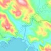
La Rinconada
The town has gained notoriety for its extreme living conditions that include its high rates of altitude sickness, pollution, poverty, murder, and sex trafficking, and as a result has sometimes been referred to in Spanish as la ciudad sin ley del Perú, which means "the lawless city of Peru".
Average elevation: 16,152 ft
La Rinconada
High in the Andes, La Rinconada has an alpine tundra climate (ET, according to the Köppen climate classification), with no month having mean temperatures even close to the 10 °C (50 °F) threshold that would permit tree growth and a subtropical highland classification for the city. Far above the tree line,…
Average elevation: 16,152 ft