
乃龙乡 topographic map
Interactive map
Click on the map to display elevation.
About this map
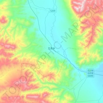
Name: 乃龙乡 topographic map, elevation, terrain.
Location: 乃龙乡, 聂拉木县, 日喀则市, 西藏自治区, 中国 (28.55928 86.22668 28.74720 86.54739)
Average elevation: 15,787 ft
Minimum elevation: 14,196 ft
Maximum elevation: 19,350 ft
Other topographic maps
Click on a map to view its topography, its elevation and its terrain.