
骆驼湖 topographic map
Interactive map
Click on the map to display elevation.
About this map
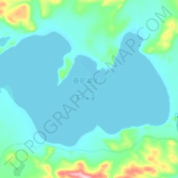
Name: 骆驼湖 topographic map, elevation, terrain.
Location: 骆驼湖, 东汝, 日土县, 阿里地区, 西藏自治区, 中国 (34.40425 81.87375 34.47700 82.00975)
Average elevation: 16,841 ft
Minimum elevation: 16,726 ft
Maximum elevation: 17,638 ft
骆驼湖(藏语:རྔ་མོང་མཚོ,威利:rnga mong mtsho,THL:Ngamong Tso)位于中国西藏自治区西部阿里地区日土县境内,地处日土县东北部,清澈湖以东,湖面海拔5103米,面积62平方公里,为一咸水湖,无常年性入湖河流。湖区气候干寒,年均气温-6~-4℃,年均降水量75毫米。
Other topographic maps
Click on a map to view its topography, its elevation and its terrain.