
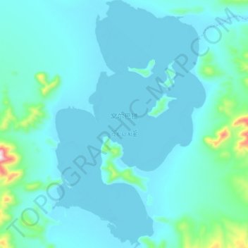
窝尔巴错 topographic map
Interactive map
Click on the map to display elevation.
About this map
Name: 窝尔巴错 topographic map, elevation, terrain.
Location: 窝尔巴错, 东汝, 日土县, 阿里地区, 西藏自治区, 中国 (34.45150 80.97800 34.60450 81.09300)
Average elevation: 17,211 ft
Minimum elevation: 17,028 ft
Maximum elevation: 19,131 ft
窝尔巴错(藏语:འོར་པ་མཚོ,威利:'or pa mtsho)位于中国西藏自治区西部阿里地区日土县多玛乡境内,地处日土县北部,面积89平方公里,湖面海拔5177米(一说5465米)。湖中有多座小岛,为世界上海拔最高的岛屿之一。北部有饮水河与东北部的邦达错连通。
Other topographic maps
Click on a map to view its topography, its elevation and its terrain.