
Kongsvinger topographic map
Interactive map
Click on the map to display elevation.
About this map
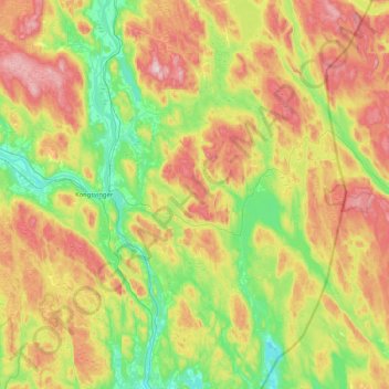
Name: Kongsvinger topographic map, elevation, terrain.
Location: Kongsvinger, Innlandet, Norway (59.98171 11.83072 60.39814 12.54189)
Average elevation: 948 ft
Minimum elevation: 404 ft
Maximum elevation: 1,850 ft
Other topographic maps
Click on a map to view its topography, its elevation and its terrain.