
莲塘镇 topographic map
Interactive map
Click on the map to display elevation.
About this map
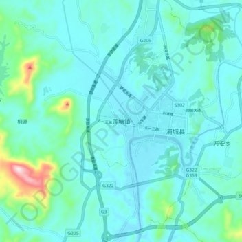
Name: 莲塘镇 topographic map, elevation, terrain.
Location: 莲塘镇, 南平市, 福建省, 中国 (27.88389 118.47611 27.96389 118.55611)
Average elevation: 919 ft
Minimum elevation: 722 ft
Maximum elevation: 2,162 ft
Other topographic maps
Click on a map to view its topography, its elevation and its terrain.