
石坪桥街道 topographic map
Interactive map
Click on the map to display elevation.
About this map
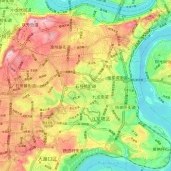
Name: 石坪桥街道 topographic map, elevation, terrain.
Location: 石坪桥街道, 九龙坡区, 重庆市主城都市区, 重庆市, 400016, 中国 (29.48034 106.45878 29.56034 106.53878)
Average elevation: 902 ft
Minimum elevation: 482 ft
Maximum elevation: 1,401 ft
Other topographic maps
Click on a map to view its topography, its elevation and its terrain.