
黄桷坪街道 topographic map
Interactive map
Click on the map to display elevation.
About this map
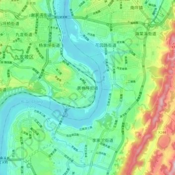
Name: 黄桷坪街道 topographic map, elevation, terrain.
Location: 黄桷坪街道, 九龙坡区, 重庆市主城都市区, 重庆市, 400067, 中国 (29.45079 106.50029 29.53079 106.58029)
Average elevation: 850 ft
Minimum elevation: 482 ft
Maximum elevation: 1,772 ft
Other topographic maps
Click on a map to view its topography, its elevation and its terrain.