
中梁山街道 topographic map
Interactive map
Click on the map to display elevation.
About this map
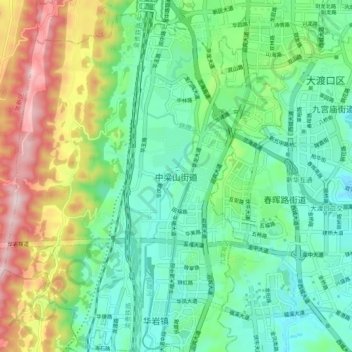
Name: 中梁山街道 topographic map, elevation, terrain.
Location: 中梁山街道, 九龙坡区, 重庆市主城都市区, 重庆市, 中国 (29.42433 106.39919 29.50433 106.47919)
Average elevation: 1,145 ft
Minimum elevation: 653 ft
Maximum elevation: 2,254 ft
Other topographic maps
Click on a map to view its topography, its elevation and its terrain.