
Cameron Island topographic map
Click on the map to display elevation.
About this map
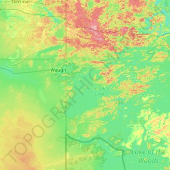
Name: Cameron Island topographic map, elevation, terrain.
Average elevation: 1,109 ft
Minimum elevation: 1,024 ft
Maximum elevation: 1,362 ft
Other topographic maps
Click on a map to view its topography, its elevation and its terrain.
Dogtooth Lake
Canada > Ontario > Kenora District > Unorganized Kenora District
Average elevation: 1,184 ft
MacDowell Lake
Canada > Ontario > Kenora District > Unorganized Kenora District
Average elevation: 1,266 ft
Big Canon Lake
Canada > Ontario > Kenora District > Unorganized Kenora District
Average elevation: 1,191 ft
Minnitaki Lake
Canada > Ontario > Kenora District > Unorganized Kenora District
Average elevation: 1,266 ft
lac Seul
Canada > Ontario > Kenora District > Unorganized Kenora District
Lac Seul is a large, crescent shaped reservoir in Kenora District, northwestern Ontario, Canada. It is approximately 241 km (150 mi) long. It has a maximum (regulated) depth of 47.2 m, with a surface elevation of 357 m above sea level. Its level is raised in the summer and then drawn down in the winter months…
Average elevation: 1,227 ft
Granite Lake
Canada > Ontario > Kenora District > Unorganized Kenora District
Average elevation: 1,165 ft
Wolf Island
Canada > Ontario > Kenora District > Unorganized Kenora District
Average elevation: 1,073 ft
Rowdy Lake
Canada > Ontario > Kenora District > Unorganized Kenora District
Average elevation: 1,214 ft
Burditt Lake
Canada > Ontario > Kenora District > Unorganized Kenora District
Average elevation: 1,204 ft
Lake Charles
Canada > Ontario > Kenora District > Unorganized Kenora District
Average elevation: 1,135 ft
Fiddler Lake
Canada > Ontario > Kenora District > Unorganized Kenora District
Average elevation: 961 ft
Cardinal (Lac) Lake
Canada > Ontario > Kenora District > Unorganized Kenora District
Average elevation: 1,286 ft
Star Lake
Canada > Ontario > Kenora District > Unorganized Kenora District
Average elevation: 1,253 ft
Big Island Lake
Canada > Ontario > Kenora District > Unorganized Kenora District
Average elevation: 1,411 ft
Arpin Lake
Canada > Ontario > Kenora District > Unorganized Kenora District
Average elevation: 1,257 ft
Artery Lake
Canada > Ontario > Kenora District > Unorganized Kenora District
Average elevation: 1,096 ft
Carroll Lake
Canada > Ontario > Kenora District > Unorganized Kenora District
Average elevation: 1,109 ft
Beauty Lake
Canada > Ontario > Kenora District > Unorganized Kenora District
Average elevation: 1,142 ft
Maynard Lake
Canada > Ontario > Kenora District > Unorganized Kenora District
Average elevation: 1,106 ft
Boyne Lake
Canada > Ontario > Kenora District > Unorganized Kenora District
Average elevation: 1,184 ft
Whitefish Lake
Canada > Ontario > Kenora District > Unorganized Kenora District
Average elevation: 1,247 ft
Dingwall Island
Canada > Ontario > Kenora District > Unorganized Kenora District
Average elevation: 1,066 ft
Kushog Lake
Canada > Ontario > Kenora District > Unorganized Kenora District
Average elevation: 1,329 ft
Confederation Lake
Canada > Ontario > Kenora District > Unorganized Kenora District
Average elevation: 1,358 ft
Fredart Lake
Canada > Ontario > Kenora District > Unorganized Kenora District
Average elevation: 1,342 ft
Two Island Lake
Canada > Ontario > Kenora District > Unorganized Kenora District
Average elevation: 1,184 ft
Affleck Lake
Canada > Ontario > Kenora District > Unorganized Kenora District
Average elevation: 1,381 ft
Spadina Lake
Canada > Ontario > Kenora District > Unorganized Kenora District
Average elevation: 1,234 ft
McIntosh Lake
Canada > Ontario > Kenora District > Unorganized Kenora District
Average elevation: 1,296 ft
Blackstone Lake
Canada > Ontario > Kenora District > Unorganized Kenora District
Average elevation: 1,253 ft
Bass Lake
Canada > Ontario > Kenora District > Unorganized Kenora District
Average elevation: 1,270 ft
Twin Lake
Canada > Ontario > Kenora District > Unorganized Kenora District
Average elevation: 1,309 ft
Clear Lake
Canada > Ontario > Kenora District > Unorganized Kenora District
Average elevation: 1,204 ft
Winnipeg River
Canada > Ontario > Kenora District > Unorganized Kenora District
Average elevation: 1,040 ft
Grindstone Lake
Canada > Ontario > Kenora District > Unorganized Kenora District
Average elevation: 1,217 ft
Look Lake
Canada > Ontario > Kenora District > Unorganized Kenora District
Average elevation: 1,289 ft
Cygnet Lake
Canada > Ontario > Kenora District > Unorganized Kenora District
Average elevation: 1,112 ft
Warwick Lake
Canada > Ontario > Kenora District > Unorganized Kenora District
Average elevation: 1,119 ft
Slate Islands
Canada > Ontario > Kenora District > Unorganized Kenora District
Average elevation: 1,056 ft
Brock Lake
Canada > Ontario > Kenora District > Unorganized Kenora District
Average elevation: 1,020 ft
Bertrand Lake
Canada > Ontario > Kenora District > Unorganized Kenora District
Average elevation: 1,358 ft
Nine Mile Lake
Canada > Ontario > Kenora District > Unorganized Kenora District
Average elevation: 1,355 ft
Mills Lake
Canada > Ontario > Kenora District > Unorganized Kenora District
Average elevation: 1,247 ft
Chisholm Island
Canada > Ontario > Kenora District > Unorganized Kenora District
Average elevation: 1,060 ft
Stormy Lake
Canada > Ontario > Kenora District > Unorganized Kenora District
Average elevation: 1,358 ft
Muskeg River
Canada > Ontario > Kenora District > Unorganized Kenora District
Average elevation: 1,171 ft
Muskeg River
Canada > Ontario > Kenora District > Unorganized Kenora District
Average elevation: 1,191 ft
Eagle Lake
Canada > Ontario > Kenora District > Unorganized Kenora District
Average elevation: 1,243 ft
Tablerock Lake
Canada > Ontario > Kenora District > Unorganized Kenora District
Average elevation: 1,260 ft
Wabaskang Lake
Canada > Ontario > Kenora District > Unorganized Kenora District
Average elevation: 1,230 ft
Minnitaki Lake
Canada > Ontario > Kenora District > Unorganized Kenora District
Average elevation: 1,266 ft
Kukukus Lake
Canada > Ontario > Kenora District > Unorganized Kenora District
Average elevation: 1,329 ft
Antenna Lake
Canada > Ontario > Kenora District > Unorganized Kenora District
Average elevation: 1,289 ft
Cluster Lakes
Canada > Ontario > Kenora District > Unorganized Kenora District
Average elevation: 1,453 ft
Little Boulder Lake
Canada > Ontario > Kenora District > Unorganized Kenora District
Average elevation: 1,178 ft
Swan Lake
Canada > Ontario > Kenora District > Unorganized Kenora District
Average elevation: 1,060 ft