
Smoke Lake topographic map
Click on the map to display elevation.
About this map
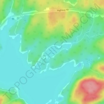
Name: Smoke Lake topographic map, elevation, terrain.
Average elevation: 1,440 ft
Minimum elevation: 1,342 ft
Maximum elevation: 1,670 ft
Other topographic maps
Click on a map to view its topography, its elevation and its terrain.
Kawawaymog Lake
Canada > Ontario > Nipissing District > Unorganized South Nipissing
Average elevation: 1,263 ft
Guthrie Lake
Canada > Ontario > Nipissing District > Unorganized South Nipissing
Average elevation: 981 ft
Rowan Lake
Canada > Ontario > Nipissing District > Unorganized South Nipissing
Average elevation: 922 ft
Madawaska Highlands
Canada > Ontario > Nipissing District > Unorganized South Nipissing
Average elevation: 1,217 ft
Crotch Lake
Canada > Ontario > Nipissing District > Unorganized South Nipissing
Average elevation: 1,358 ft
Ralph Bice Lake
Canada > Ontario > Nipissing District > Unorganized South Nipissing
Average elevation: 1,522 ft
Wenona Lake
Canada > Ontario > Nipissing District > Unorganized South Nipissing
Average elevation: 1,532 ft
Cedar Lake
Canada > Ontario > Nipissing District > Unorganized South Nipissing
Average elevation: 1,214 ft
Moccasin Lake
Canada > Ontario > Nipissing District > Unorganized South Nipissing
Average elevation: 1,526 ft
Sunday Lake
Canada > Ontario > Nipissing District > Unorganized South Nipissing
Average elevation: 1,522 ft
Mew Lake
Canada > Ontario > Nipissing District > Unorganized South Nipissing
Average elevation: 1,375 ft
Bissett Lake
Canada > Ontario > Nipissing District > Unorganized South Nipissing
Average elevation: 1,204 ft
Biggar Lake
Canada > Ontario > Nipissing District > Unorganized South Nipissing
Average elevation: 1,342 ft
Cedar Lake
Canada > Ontario > Nipissing District > Unorganized South Nipissing
Average elevation: 1,214 ft
Pog Lake
Canada > Ontario > Nipissing District > Unorganized South Nipissing
Average elevation: 1,362 ft
Maple Leaf Lake
Canada > Ontario > Nipissing District > Unorganized South Nipissing
Average elevation: 1,673 ft
Sheriff Pond
Canada > Ontario > Nipissing District > Unorganized South Nipissing
Average elevation: 1,496 ft
Radiant Lake
Canada > Ontario > Nipissing District > Unorganized South Nipissing
Average elevation: 968 ft
Bridle Lake
Canada > Ontario > Nipissing District > Unorganized South Nipissing
Average elevation: 1,411 ft