
东河区 topographic map
Interactive map
Click on the map to display elevation.
About this map
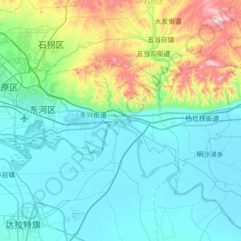
Name: 东河区 topographic map, elevation, terrain.
Location: 东河区, 包头市, 内蒙古自治区, 014000, 中国 (40.46107 109.94734 40.65216 110.43720)
Average elevation: 3,757 ft
Minimum elevation: 3,268 ft
Maximum elevation: 6,079 ft
Other topographic maps
Click on a map to view its topography, its elevation and its terrain.