
达尔罕茂明安联合旗 topographic map
Interactive map
Click on the map to display elevation.
About this map
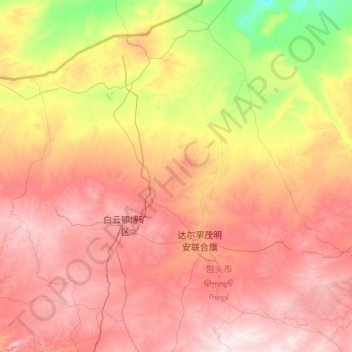
Name: 达尔罕茂明安联合旗 topographic map, elevation, terrain.
Location: 达尔罕茂明安联合旗, 包头市, 内蒙古自治区, 014000, 中国 (41.23542 109.26244 42.73599 111.43633)
Average elevation: 4,455 ft
Minimum elevation: 3,107 ft
Maximum elevation: 6,280 ft
Other topographic maps
Click on a map to view its topography, its elevation and its terrain.