
石拐区 topographic map
Interactive map
Click on the map to display elevation.
About this map
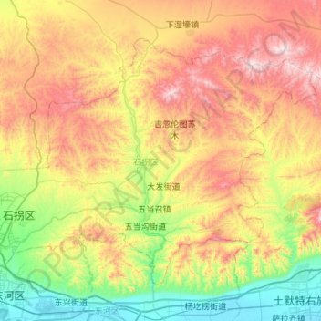
Name: 石拐区 topographic map, elevation, terrain.
Location: 石拐区, 包头市, 内蒙古自治区, 014000, 中国 (40.58843 110.01721 40.89494 110.54573)
Average elevation: 4,711 ft
Minimum elevation: 3,268 ft
Maximum elevation: 6,880 ft
Other topographic maps
Click on a map to view its topography, its elevation and its terrain.