Geolocate

Longridge Fell topographic map

Click on the map to display elevation.

About this map

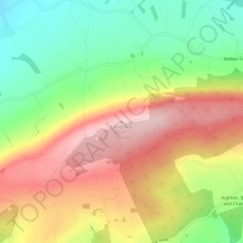
Name: Longridge Fell topographic map, elevation, terrain.

Location: Longridge Fell, Ribble Valley, Lancashire, England, BB7 3LY, United Kingdom (53.86457 -2.52164 53.86467 -2.52154)

Average elevation: 715 ft

Minimum elevation: 318 ft

Maximum elevation: 1,125 ft

Other topographic maps

Click on a map to view its topography, its elevation and its terrain.

Rimington

United Kingdom > England > Lancashire > Ribble Valley > Rimington

Average elevation: 584 ft

Ramsgreave

United Kingdom > England > Lancashire > Ribble Valley

Average elevation: 518 ft

Read

United Kingdom > England > Lancashire > Ribble Valley > Read

Average elevation: 374 ft

Mellor

United Kingdom > England > Lancashire > Ribble Valley > Mellor

Average elevation: 456 ft

Gisburn

United Kingdom > England > Lancashire > Ribble Valley

Average elevation: 525 ft

Clitheroe

United Kingdom > England > Lancashire > Ribble Valley

Average elevation: 276 ft

Whalley

United Kingdom > England > Lancashire > Ribble Valley

Average elevation: 312 ft

Ribchester

United Kingdom > England > Lancashire > Ribble Valley

Average elevation: 364 ft

West Bradford

United Kingdom > England > Lancashire > Ribble Valley

Average elevation: 620 ft

Longridge

United Kingdom > England > Lancashire > Ribble Valley > Longridge

Average elevation: 292 ft

Slaidburn

United Kingdom > England > Lancashire > Ribble Valley

Average elevation: 823 ft

Newton

United Kingdom > England > Lancashire > Ribble Valley

Average elevation: 732 ft

Chipping

United Kingdom > England > Lancashire > Ribble Valley

Average elevation: 636 ft

Jamacia Wood

United Kingdom > England > Lancashire > Ribble Valley > Langho

Average elevation: 328 ft

Barrow

United Kingdom > England > Lancashire > Ribble Valley

Average elevation: 276 ft

Wilpshire

United Kingdom > England > Lancashire > Ribble Valley > Wilpshire

Average elevation: 489 ft

Sabden

United Kingdom > England > Lancashire > Ribble Valley

Average elevation: 774 ft

Newsholme

United Kingdom > England > Lancashire > Ribble Valley

Average elevation: 459 ft

Dutton

United Kingdom > England > Lancashire > Ribble Valley

Average elevation: 440 ft

Jamacia Wood

United Kingdom > England > Lancashire > Ribble Valley > Langho

Average elevation: 328 ft

Jamacia Wood

United Kingdom > England > Lancashire > Ribble Valley > Langho

Average elevation: 328 ft

Gear up for your next adventure:

🪶Fire Starter Kit - Reliable fire starter for survival and camping
🛰️Satellite Messengers - Emergency SOS and two-way messaging for off-grid adventures
🪄Magnetic Compass - Accurate compass for navigation
🛠️Outdoor Gear Repair Kit - Essential tools to fix gear on the trail
📦Dry Bags Set - Waterproof storage for electronics and clothes

As an Amazon Associate, this site earns from qualifying purchases at no extra cost to you.