Geolocate

Pepsi topographic map

Click on the map to display elevation.

About this map

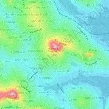
Name: Pepsi topographic map, elevation, terrain.

Location: Pepsi, Kampala, Central Region, Uganda (0.27063 32.59161 0.31063 32.63161)

Average elevation: 3,842 ft

Minimum elevation: 3,714 ft

Maximum elevation: 4,262 ft

Other topographic maps

Click on a map to view its topography, its elevation and its terrain.

Rubaga

Uganda > Central Region > Kampala

Average elevation: 3,894 ft

Nakawa

Uganda > Central Region > Kampala

Average elevation: 3,865 ft

Central

Uganda > Central Region > Kampala

Average elevation: 3,914 ft

1p

Uganda > Central Region > Kampala

Average elevation: 3,881 ft

Gear up for your next adventure:

🧦Hiking Socks - Comfortable socks to prevent blisters on long hikes
🧯Portable Fire Pit - Compact fire pit for camping spots
🏔️Mountain Trail Maps - High‑detail maps for popular peaks
🗺️NatGeo Topo Maps - High-quality waterproof printed topographic maps of US Parks
🦺Reflective Outdoor Gear - Safety gear for low‑light conditions

As an Amazon Associate, this site earns from qualifying purchases at no extra cost to you.