Geolocate

Phil topographic map

Click on the map to display elevation.

👉 Easily get elevation data in JSON, GeoTIFF and KML formats using Elevation API
Thank you for supporting this site ❤️
Make a donation

About this map

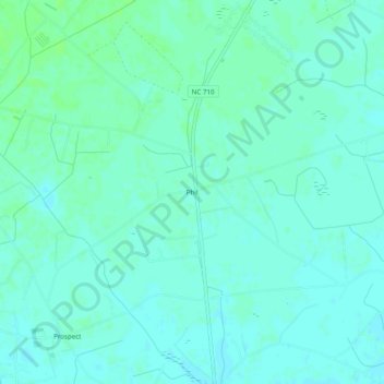
Name: Phil topographic map, elevation, terrain.

Location: Phil, Robeson County, North Carolina, United States (34.72822 -79.23393 34.76822 -79.19393)

Average elevation: 200 ft

Minimum elevation: 187 ft

Maximum elevation: 217 ft

Robeson County trails, hiking, mountain biking, running and outdoor activities

Other topographic maps

Click on a map to view its topography, its elevation and its terrain.

Rowland

United States > North Carolina > Robeson County

Average elevation: 148 ft

Prospect

United States > North Carolina > Robeson County > Prospect

Average elevation: 194 ft

McDonald

United States > North Carolina > Robeson County

Average elevation: 151 ft

Gear up for your next adventure:

🪶Wildlife Field Guides - Learn animal tracking and species ID
🦟Ultrasonic Repellers - Create a bug-free zone at your camp or rest stop
🔋Rechargeable Batteries - Power up your outdoor devices
🩳Quick‑Dry Hiking Shorts - Comfortable and quick‑dry shorts for summer hiking
👟Men's Trail Runners - Lightweight footwear for fast-paced exploration and light hiking

As an Amazon Associate, this site earns from qualifying purchases at no extra cost to you.