
汪土地湾 topographic map
Interactive map
Click on the map to display elevation.
About this map
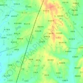
Name: 汪土地湾 topographic map, elevation, terrain.
Location: 汪土地湾, 新洲区, 武汉市, 湖北省, 中国 (30.94464 114.91642 30.98464 114.95642)
Average elevation: 171 ft
Minimum elevation: 108 ft
Maximum elevation: 249 ft
Other topographic maps
Click on a map to view its topography, its elevation and its terrain.