
永佳山 topographic map
Interactive map
Click on the map to display elevation.
About this map
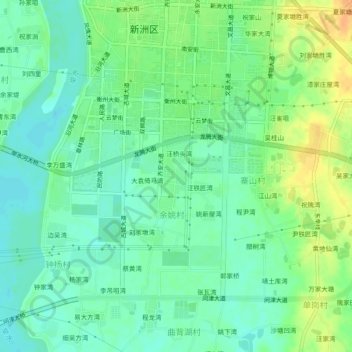
Name: 永佳山 topographic map, elevation, terrain.
Location: 永佳山, 新洲区, 武汉市, 湖北省, 中国 (30.80696 114.78029 30.84696 114.82029)
Average elevation: 92 ft
Minimum elevation: 52 ft
Maximum elevation: 157 ft
Other topographic maps
Click on a map to view its topography, its elevation and its terrain.