
乐亭县 topographic map
Interactive map
Click on the map to display elevation.
About this map
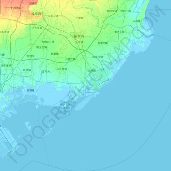
Name: 乐亭县 topographic map, elevation, terrain.
Location: 乐亭县, 唐山市, 河北省, 中国 (38.86747 118.68076 39.57369 119.54704)
Average elevation: 10 ft
Minimum elevation: -13 ft
Maximum elevation: 98 ft
Other topographic maps
Click on a map to view its topography, its elevation and its terrain.