
大柳树村 topographic map
Interactive map
Click on the map to display elevation.
About this map
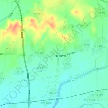
Name: 大柳树村 topographic map, elevation, terrain.
Location: 大柳树村, 唐山市, 河北省, 中国 (40.16326 118.00764 40.20326 118.04764)
Average elevation: 207 ft
Minimum elevation: 151 ft
Maximum elevation: 322 ft
Other topographic maps
Click on a map to view its topography, its elevation and its terrain.