
双井镇 topographic map
Interactive map
Click on the map to display elevation.
About this map
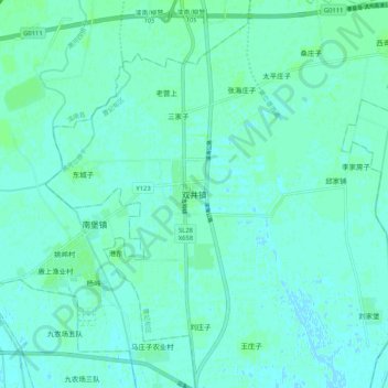
Name: 双井镇 topographic map, elevation, terrain.
Location: 双井镇, 唐山市, 河北省, 中国 (39.25239 118.61397 39.33239 118.69397)
Average elevation: 10 ft
Minimum elevation: -7 ft
Maximum elevation: 20 ft
Other topographic maps
Click on a map to view its topography, its elevation and its terrain.