
开平区 topographic map
Interactive map
Click on the map to display elevation.
About this map
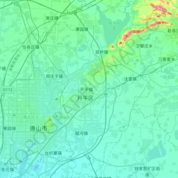
Name: 开平区 topographic map, elevation, terrain.
Location: 开平区, 唐山市, 河北省, 063000, 中国 (39.56214 118.16162 39.80166 118.38084)
Average elevation: 108 ft
Minimum elevation: 10 ft
Maximum elevation: 869 ft
Other topographic maps
Click on a map to view its topography, its elevation and its terrain.