
迁西县 topographic map
Interactive map
Click on the map to display elevation.
About this map
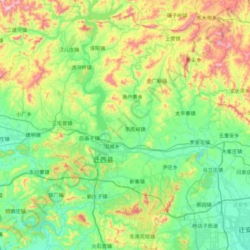
Name: 迁西县 topographic map, elevation, terrain.
Location: 迁西县, 唐山市, 河北省, 中国 (39.95514 118.11608 40.46326 118.61937)
Average elevation: 764 ft
Minimum elevation: 43 ft
Maximum elevation: 2,881 ft
Other topographic maps
Click on a map to view its topography, its elevation and its terrain.