
乐亭县 topographic map
Interactive map
Click on the map to display elevation.
About this map
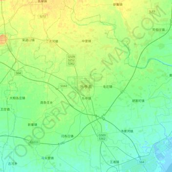
Name: 乐亭县 topographic map, elevation, terrain.
Location: 乐亭县, 唐山市, 河北省, 中国 (39.26414 118.74551 39.58414 119.06551)
Average elevation: 26 ft
Minimum elevation: -10 ft
Maximum elevation: 69 ft
Other topographic maps
Click on a map to view its topography, its elevation and its terrain.