
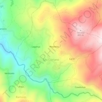
São Cipriano topographic map
Interactive map
Click on the map to display elevation.
About this map
Name: São Cipriano topographic map, elevation, terrain.
Location: São Cipriano, Resende, Viseu, Portugal (41.04996 -8.00829 41.08065 -7.96676)
Average elevation: 1,985 ft
Minimum elevation: 1,050 ft
Maximum elevation: 2,963 ft
Other topographic maps
Click on a map to view its topography, its elevation and its terrain.
Póvoa de Santo Amaro
Portugal > Viseu > Carregal do Sal > Parada
Póvoa de Santo Amaro, Parada, Carregal do Sal, Viseu, 3430-730, Portugal
Average elevation: 837 ft
Paranho de Besteiros
Paranho de Besteiros, Caparrosa e Silvares, Tondela, Viseu, 3460-454, Portugal
Average elevation: 1,503 ft
Sobral
Portugal > Viseu > São Pedro do Sul > Pinho
Sobral, Pinho, São Pedro do Sul, Viseu, Portugal
Average elevation: 1,286 ft
Rio de Mel
Portugal > Viseu > São Pedro do Sul > Pindelo dos Milagres
Rio de Mel, Pindelo dos Milagres, São Pedro do Sul, Viseu, Portugal
Average elevation: 1,329 ft
Lages de Ranhados
Portugal > Viseu > Viseu > Ranhados
Lages de Ranhados, Ranhados, Viseu, 3500-456, Portugal
Average elevation: 1,493 ft
Caselho
Portugal > Viseu > Oliveira de Frades
Caselho, Destriz e Reigoso, Oliveira de Frades, Viseu, 3750-561, Portugal
Average elevation: 1,135 ft
Canas de Senhorim
Canas de Senhorim, Nelas, Viseu, Portugal
Average elevation: 1,122 ft
Ermida
Portugal > Viseu > Castro Daire
Ermida, Picão e Ermida, Castro Daire, Viseu, Portugal
Average elevation: 1,818 ft
Cêtos
Portugal > Viseu > Castro Daire > Pinheiro
Cêtos, Pinheiro, Castro Daire, Viseu, Portugal
Average elevation: 2,418 ft
Macieira
Portugal > Viseu > Ferreirim e Macieira
Macieira, Ferreirim e Macieira, Sernancelhe, Viseu, 3640-110, Portugal
Average elevation: 2,598 ft
Beijós
Portugal > Viseu > Carregal do Sal
Beijós, Carregal do Sal, Viseu, Portugal
Average elevation: 951 ft
Mesquitela
Mesquitela, Mangualde, Viseu, 3530-051, Portugal
Average elevation: 1,588 ft
Barragem da Ribeira do Paul
Barragem da Ribeira do Paul, Vilar de Besteiros e Mosteiro de Fráguas, Tondela, Viseu, Portugal
Average elevation: 1,188 ft
Monteiras
Portugal > Viseu > Castro Daire
Monteiras, Castro Daire, Viseu, Portugal
Average elevation: 2,946 ft
Lamas
Portugal > Viseu > Sátão > Ferreira de Aves
Lamas, Ferreira de Aves, Sátão, Viseu, 3560-020, Portugal
Average elevation: 2,110 ft
Germil
Portugal > Viseu > Penalva do Castelo
Germil, Penalva do Castelo, Viseu, Portugal
Average elevation: 1,483 ft
São Pedro do Sul
Portugal > Viseu > São Pedro do Sul, Várzea e Baiões
São Pedro do Sul, São Pedro do Sul, Várzea e Baiões, São Pedro do Sul, Viseu, 3660-441, Portugal
Average elevation: 1,063 ft
Pimeirol
Portugal > Viseu > Felgueiras e Feirão > Felgueiras
Pimeirol, Felgueiras, Felgueiras e Feirão, Resende, Viseu, 4660-362, Portugal
Average elevation: 2,306 ft
Moure de Madalena
Portugal > Viseu > Viseu > Campo
Moure de Madalena, Campo, Viseu, 3515-160, Portugal
Average elevation: 1,729 ft
Louredo
Portugal > Viseu > Freigil e Miomães > Miomães
Louredo, Miomães, Freigil e Miomães, Resende, Viseu, 4640-270, Portugal
Average elevation: 833 ft
Mosteirinho
Mosteirinho, Tondela, Viseu, 3475-060, Portugal
Average elevation: 1,929 ft
Covelinho
Portugal > Viseu > Oliveira de Frades
Covelinho, São João da Serra, Oliveira de Frades, São João da Serra, Viseu, 3730-018, Portugal
Average elevation: 1,414 ft
Pindêlo
Portugal > Viseu > Nespereira
Pindêlo, Nespereira, Cinfães, Viseu, Portugal
Average elevation: 1,778 ft
Folgosa
Portugal > Viseu > Castro Daire
Folgosa, Castro Daire, Viseu, 3600-143, Portugal
Average elevation: 1,955 ft