
岗嘎镇 topographic map
Interactive map
Click on the map to display elevation.
About this map
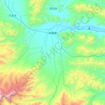
Name: 岗嘎镇 topographic map, elevation, terrain.
Location: 岗嘎镇, 定日县, 日喀则市, 西藏自治区, 中国 (28.29990 86.27222 28.69575 86.80110)
Average elevation: 16,106 ft
Minimum elevation: 14,091 ft
Maximum elevation: 23,888 ft
Other topographic maps
Click on a map to view its topography, its elevation and its terrain.