
绒辖乡 topographic map
Interactive map
Click on the map to display elevation.
About this map
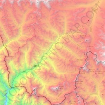
Name: 绒辖乡 topographic map, elevation, terrain.
Location: 绒辖乡, 定日县, 日喀则市, 西藏自治区, 中国 (27.90684 86.20431 28.31155 86.56871)
Average elevation: 16,768 ft
Minimum elevation: 6,522 ft
Maximum elevation: 23,953 ft
Other topographic maps
Click on a map to view its topography, its elevation and its terrain.