
扎西宗乡 topographic map
Interactive map
Click on the map to display elevation.
About this map
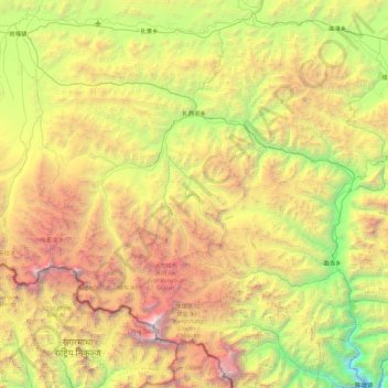
Name: 扎西宗乡 topographic map, elevation, terrain.
Location: 扎西宗乡, 定日县, 日喀则市, 西藏自治区, 中国 (27.98824 86.37326 28.52537 87.27179)
Average elevation: 16,407 ft
Minimum elevation: 8,816 ft
Maximum elevation: 28,596 ft
Other topographic maps
Click on a map to view its topography, its elevation and its terrain.