
Make a donation
Gear up for your next adventure:
As an Amazon Associate, this site earns from qualifying purchases at no extra cost to you.
Récif Morrisson topographic map
Click on the map to display elevation.
Make a donation
Gear up for your next adventure:
As an Amazon Associate, this site earns from qualifying purchases at no extra cost to you.
About this map
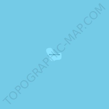
Name: Récif Morrisson topographic map, elevation, terrain.
Location: Récif Morrisson, Madagascar (-21.80877 43.21486 -21.80545 43.21900)
Average elevation: 0 ft
Minimum elevation: 0 ft
Maximum elevation: 0 ft
Make a donation
Gear up for your next adventure:
As an Amazon Associate, this site earns from qualifying purchases at no extra cost to you.
Other topographic maps
Click on a map to view its topography, its elevation and its terrain.
Make a donation
Gear up for your next adventure:
As an Amazon Associate, this site earns from qualifying purchases at no extra cost to you.
Make a donation
Gear up for your next adventure:
As an Amazon Associate, this site earns from qualifying purchases at no extra cost to you.
Make a donation
Gear up for your next adventure:
As an Amazon Associate, this site earns from qualifying purchases at no extra cost to you.
Make a donation
Gear up for your next adventure:
As an Amazon Associate, this site earns from qualifying purchases at no extra cost to you.
Antsirabe
Madagascar > Vakinankaratra > Antsirabe I
Antsirabe is situated at an altitude of about 1,500 m (4,900 ft), making its subtropical highland climate (Köppen: Cwb), similar to Brazilian high cities of the southeast. During the winter the temperature can fall below 0 °C (32 °F) at night, and Antsirabe has recorded the lowest temperature in Madagascar…
Average elevation: 5,482 ft
Make a donation
Gear up for your next adventure:
As an Amazon Associate, this site earns from qualifying purchases at no extra cost to you.
Antsirabe
Antsirabe is situated at an altitude of about 1,500 m (4,900 ft), making its subtropical highland climate (Köppen: Cwb), similar to Brazilian high cities of the southeast. During the winter the temperature can fall below 0 °C (32 °F) at night, and Antsirabe has recorded the lowest temperature in Madagascar…
Average elevation: 5,482 ft
Make a donation
Gear up for your next adventure:
As an Amazon Associate, this site earns from qualifying purchases at no extra cost to you.
Antananarivo
Antananarivo (Malagasy: [antananaˈrivʷ]; French: Tananarive, pronounced [tananaʁiv]), also known by its colonial shorthand form Tana (pronounced [tana]), is the capital and largest city of Madagascar. The administrative area of the city, known as Antananarivo-Renivohitra ("Antananarivo-Mother Hill" or…
Average elevation: 4,295 ft
Make a donation
Gear up for your next adventure:
As an Amazon Associate, this site earns from qualifying purchases at no extra cost to you.
Bongolava
The region is situated in central-western Madagascar. It is bordered by Betsiboka, Melaky, Menabe, Vakinankaratra, Itasy and Analamanga. The altitude ranges from 800 m (2,600 ft) to 1,500 m (4,900 ft).
Average elevation: 3,238 ft
Make a donation
Gear up for your next adventure:
As an Amazon Associate, this site earns from qualifying purchases at no extra cost to you.
Antananarivo
Antananarivo (Malagasy: [antananaˈrivʷ]; French: Tananarive, pronounced [tananaʁiv]), also known by its colonial shorthand form Tana (pronounced [tana]), is the capital and largest city of Madagascar. The administrative area of the city, known as Antananarivo-Renivohitra ("Antananarivo-Mother Hill" or…
Average elevation: 4,295 ft
Make a donation
Gear up for your next adventure:
As an Amazon Associate, this site earns from qualifying purchases at no extra cost to you.
Fianarantsoa
Madagascar > Haute Matsiatra > District de Fianarantsoa
It is at an average altitude of 1,200 metres (3,900 ft), and has a population of 191,766.
Average elevation: 3,845 ft
Make a donation
Gear up for your next adventure:
As an Amazon Associate, this site earns from qualifying purchases at no extra cost to you.
Make a donation
Gear up for your next adventure:
As an Amazon Associate, this site earns from qualifying purchases at no extra cost to you.
Make a donation
Gear up for your next adventure:
As an Amazon Associate, this site earns from qualifying purchases at no extra cost to you.
Make a donation
Gear up for your next adventure:
As an Amazon Associate, this site earns from qualifying purchases at no extra cost to you.
Doany-Antafondro
Madagascar > Diana Region > District de Nosy Be > Antafondro
Average elevation: 46 ft
Make a donation
Gear up for your next adventure:
As an Amazon Associate, this site earns from qualifying purchases at no extra cost to you.
Fianarantsoa
Madagascar > Haute Matsiatra > District de Fianarantsoa
It is at an average altitude of 1,200 metres (3,900 ft), and has a population of 191,766.
Average elevation: 3,845 ft
Make a donation
Gear up for your next adventure:
As an Amazon Associate, this site earns from qualifying purchases at no extra cost to you.
Make a donation
Gear up for your next adventure:
As an Amazon Associate, this site earns from qualifying purchases at no extra cost to you.
Make a donation
Gear up for your next adventure:
As an Amazon Associate, this site earns from qualifying purchases at no extra cost to you.
Make a donation
Gear up for your next adventure:
As an Amazon Associate, this site earns from qualifying purchases at no extra cost to you.
Antananarivo
Antananarivo (Malagasy: [antananaˈrivʷ]; French: Tananarive, pronounced [tananaʁiv]), also known by its colonial shorthand form Tana (pronounced [tana]), is the capital and largest city of Madagascar. The administrative area of the city, known as Antananarivo-Renivohitra ("Antananarivo-Mother Hill" or…
Average elevation: 4,295 ft
Make a donation
Gear up for your next adventure:
As an Amazon Associate, this site earns from qualifying purchases at no extra cost to you.
Make a donation
Gear up for your next adventure:
As an Amazon Associate, this site earns from qualifying purchases at no extra cost to you.
Make a donation
Gear up for your next adventure:
As an Amazon Associate, this site earns from qualifying purchases at no extra cost to you.
Isalo National Park
Madagascar > Ihorombe > Ranohira
Isalo National Park is a National Park in the Ihorombe Region of Madagascar, in the southwestern corner of the Province of Fianarantsoa. The closest town is Ranohira, and the closest cities are Toliara and Ihosy. It is a sandstone landscape that has been dissected by wind and water erosion into rocky outcrops,…
Average elevation: 2,635 ft
Make a donation
Gear up for your next adventure:
As an Amazon Associate, this site earns from qualifying purchases at no extra cost to you.
Fianarantsoa
Madagascar > Haute Matsiatra > District de Fianarantsoa
It is at an average altitude of 1,200 metres (3,900 ft), and has a population of 191,766.
Average elevation: 3,845 ft
Make a donation
Gear up for your next adventure:
As an Amazon Associate, this site earns from qualifying purchases at no extra cost to you.
Madagascar
Madagascar > Province d’Antananarivo
Madagascar can be divided into five general geographical regions: the east coast, the Tsaratanana Massif, the Central Highlands, the west coast, and the southwest. The highest elevations parallel the east coast.
Average elevation: 472 ft
Antananarivo
Antananarivo (French: Tananarive, pronounced [tananaʁiv]), also known by its colonial shorthand form Tana, is the capital and largest city of Madagascar. The administrative area of the city, known as Antananarivo-Renivohitra ("Antananarivo-Mother Hill" or "Antananarivo-Capital"), is the capital of Analamanga…
Average elevation: 4,295 ft
Make a donation
Gear up for your next adventure:
As an Amazon Associate, this site earns from qualifying purchases at no extra cost to you.
Fianarantsoa
Madagascar > Haute Matsiatra > District de Fianarantsoa > Fianarantsoa
Average elevation: 3,940 ft
Make a donation
Gear up for your next adventure:
As an Amazon Associate, this site earns from qualifying purchases at no extra cost to you.