
Baras topographic map
Click on the map to display elevation.
About this map
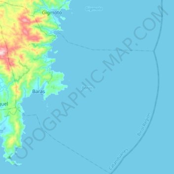
Name: Baras topographic map, elevation, terrain.
Location: Baras, Catanduanes, Bicol Region, Philippines (13.53392 124.30345 13.79716 124.55746)
Average elevation: 151 ft
Minimum elevation: -7 ft
Maximum elevation: 2,365 ft
Other topographic maps
Click on a map to view its topography, its elevation and its terrain.