
Førland topographic map
Interactive map
Click on the map to display elevation.
About this map
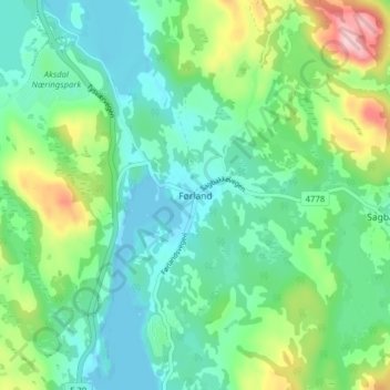
Name: Førland topographic map, elevation, terrain.
Location: Førland, Tysvær, Rogaland, 5570, Norwegen (59.37508 5.46174 59.41508 5.50174)
Average elevation: 180 ft
Minimum elevation: -16 ft
Maximum elevation: 669 ft
Other topographic maps
Click on a map to view its topography, its elevation and its terrain.