
Bjoa topographic map
Interactive map
Click on the map to display elevation.
About this map
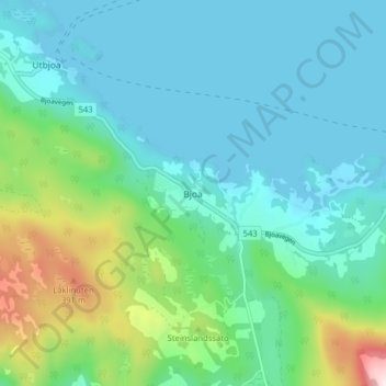
Name: Bjoa topographic map, elevation, terrain.
Location: Bjoa, Vindafjord, Rogaland, 5584, Norwegen (59.64488 5.62283 59.68488 5.66283)
Average elevation: 341 ft
Minimum elevation: -3 ft
Maximum elevation: 1,654 ft
Other topographic maps
Click on a map to view its topography, its elevation and its terrain.