
Vikedal topographic map
Interactive map
Click on the map to display elevation.
About this map
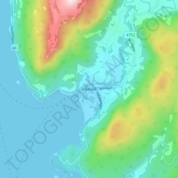
Name: Vikedal topographic map, elevation, terrain.
Location: Vikedal, Vindafjord, Rogaland, Norwegen (59.47812 5.88259 59.51812 5.92259)
Average elevation: 449 ft
Minimum elevation: 0 ft
Maximum elevation: 2,083 ft
Other topographic maps
Click on a map to view its topography, its elevation and its terrain.