

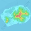
Teauaone topographic map
Click on the map to display elevation.
About this map

Name: Teauaone topographic map, elevation, terrain.
Average elevation: 0 ft
Minimum elevation: 0 ft
Maximum elevation: 26 ft
Other topographic maps
Click on a map to view its topography, its elevation and its terrain.

Rapa
Rapa, also called Rapa Iti ("Little Rapa"), is the largest and only inhabited island of the Bass Islands in French Polynesia. An older name for the island is Oparo. The total land area including offshore islets is 40.5 km2 (15.6 sq mi). As of the 2022 census, Rapa had a population of 451. The island's highest…
Average elevation: 3 ft
Mo’orea
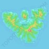
Many Moʼorean endemic species have gone extinct or been extirpated. The Polynesian tree snails of the genus Partula were largely wiped out after the rosy wolf snail was introduced in 1977, although captive and small refuge populations on Tahiti still exist. In 2019 both Partula rosea and Partula varia were…
Average elevation: 282 ft

Bora-Bora
France > French Polynesia > Bora-Bora
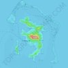
The bay of Tuuraapuo was the main crater of the volcano, whose collapsed southwestern edge only subsists still in the islets Toopua and Toopua-iti, which culminate respectively at 148 m (486 ft) and 17 m (56 ft), altitude. The volcanic rocks are of basaltic type, consisting mostly of alkaline basalts, some…
Average elevation: 36 ft
Bora-Bora
France > French Polynesia > Bora-Bora
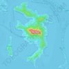
The bay of Tuuraapuo was the main crater of the volcano, whose collapsed southwestern edge only subsists still in the islets Toopua and Toopua-iti, which culminate respectively at 148 m (486 ft) and 17 m (56 ft), altitude. The volcanic rocks are of basaltic type, consisting mostly of alkaline basalts, some…
Average elevation: 36 ft

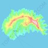
Ua Huka
France > French Polynesia > Ua Huka
The island is shaped approximately like a crescent, with its concave edge facing the south. The land area is approximately 83 km2 (32 sq. mi.). The center of the island is a high plateau, deeply indented in places by narrow river valleys. The highest peak, Hitikau reaches an elevation of 884 metres (2,900 ft).
Average elevation: 331 ft
Ra’iātea
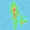
There are three main mountain masses on the island, connected by lower ridges. The central mass includes Mount Tefatoaiti (1,017 m), the island's highest peak. The northern mass is known as the Temehani Plateau. The plateau generally undulates between 600 and 650 metres elevation, rising higher in places…
Average elevation: 203 ft
Nuku Hiva
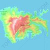
On the western edge of To'ovi'i rises Tekao, the island's highest peak, which reaches an elevation of 1,224 metres (4,016 ft). The western and northern edges of To'ovi'i are a mountain ridge, which catches much of the rain that waters the island.
Average elevation: 614 ft
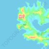
Rapa
France > French Polynesia > Rapa
Rapa, also called Rapa Iti, or "Little Rapa", to distinguish it from Easter Island, whose Polynesian name is Rapa Nui, is the largest and only inhabited island of the Bass Islands in French Polynesia. An older name for the island is Oparo. The total land area including offshore islets is 40.5 km2 (15.6 sq mi).…
Average elevation: 174 ft
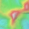
Mont Orohena
France > French Polynesia > Windward Islands > Māhina
Mont Orohena is a mountain located in the South Pacific, on the island of Tahiti. With an elevation of 2,241 metres (7,352 ft) above sea level, it is the highest point of French Polynesia. Mont Orohena is an extinct volcano and ranks 7th in the world for topographic isolation.
Average elevation: 4,206 ft
Bora-Bora
France > French Polynesia > Bora-Bora
The bay of Tuuraapuo was the main crater of the volcano, whose collapsed southwestern edge only subsists still in the islets Toopua and Toopua-iti, which culminate respectively at 148 m (486 ft) and 17 m (56 ft), altitude. The volcanic rocks are of basaltic type, consisting mostly of alkaline basalts, some…
Average elevation: 36 ft
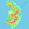
Fatu Hiva
France > French Polynesia > Fatu Hiva
The mountain rainforest still harbours some endemic plants, such as Ochrosia fatuhivensis and Melicope fatuhivensis (syn. Pelea fatuhivensis), a tree of the Rutaceae family which may already be extinct. Pterophylla tremuloides is an endemic shrub which grows in low ridge top and cliff shrubland with…
Average elevation: 423 ft

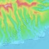


Papeete
France > French Polynesia > Windward Islands
Previously, during the construction of the Faʻaiere water tower with a capacity of 150,000 litres for the drinking water supply of the city of Papeʻetē, a difference in altitude of 37 metres (121 ft) was overcome with a light railway laid on a 220 metres (720 ft) long inclined plane. A winch driven by a…
Average elevation: 735 ft
Hiva Oa
Hiva Oa is the largest and most fertile of the southern Marquesas islands and second only to Nuku Hiva in size. Similar to all the larger Marquesas, Hiva Oa features steep cliffs abruptly rising from the ocean to a rugged interior spine of volcanic mountains, ridges, and deep, isolated valleys. Unlike most…
Average elevation: 259 ft
Marquesas Islands
Although Polynesia tends to be associated with images of lush tropical vegetation, and the Marquesas lie within the tropics, they are remarkably dry. That is because they constitute the first major break for the prevailing easterly winds that arise from the (atmospherically) dry Humboldt Current. This subjects…
Average elevation: 10 ft
Mo’orea
Many Moʼorean endemic species have gone extinct or been extirpated. The Polynesian tree snails of the genus Partula were largely wiped out after the rosy wolf snail was introduced in 1977, although captive and small refuge populations on Tahiti still exist. In 2019 both Partula rosea and Partula varia were…
Average elevation: 282 ft
Tahuata
France > French Polynesia > Marquesas Islands > Tahuata
The land area of Tahuata is 61.0 km2 (23.6 sq mi). The highest point on the island is Mount Amatea (French: Mont Amatea), rising to an elevation of 1,050 m (3,445 ft.). The island is very mountainous, with deep valleys and cliffs. The orography does not allow the construction of an airstrip and communications…
Average elevation: 262 ft
Papeete
Previously, during the construction of the Faʻaiere water tower with a capacity of 150,000 litres for the drinking water supply of the city of Papeʻetē, a difference in altitude of 37 metres (121 ft) was overcome with a light railway laid on a 220 metres (720 ft) long inclined plane. A winch driven by a…
Average elevation: 735 ft
Fatu Hiva
France > French Polynesia > Fatu Hiva
The mountain rainforest still harbours some endemic plants, such as Ochrosia fatuhivensis and Melicope fatuhivensis (syn. Pelea fatuhivensis), a tree of the Rutaceae family which may already be extinct. Pterophylla tremuloides is an endemic shrub which grows in low ridge top and cliff shrubland with…
Average elevation: 423 ft

Moho Tani
France > French Polynesia > Marquesas Islands > Hiva Oa
It is a high island, with its highest elevation (520 meters) in the south, and its overall shape resembles the back of a whale.
Average elevation: 135 ft
Nuku Hiva
France > French Polynesia > Marquesas Islands
On the western edge of To'ovi'i rises Tekao, the island's highest peak, which reaches an elevation of 1,224 metres (4,016 ft). The western and northern edges of To'ovi'i are a mountain ridge, which catches much of the rain that waters the island.
Average elevation: 614 ft
Ra’iātea
There are three main mountain masses on the island, connected by lower ridges. The central mass includes Mount Tefatoaiti (1,017 m), the island's highest peak. The northern mass is known as the Temehani Plateau. The plateau generally undulates between 600 and 650 metres elevation, rising higher in places…
Average elevation: 203 ft
Ua Pou
France > French Polynesia > Marquesas Islands > Ua Pou
It is located about 50 km (30 mi.) south of Nuku Hiva, in the northern Marquesas. The center of the island is characterized by four high basalt pillars that reach high above the surrounding mountains. The highest of these pillars, Mount Oave (Mont Oave), reaches to 1,230 m (4,040 ft) above sea level and is the…
Average elevation: 417 ft




Nuku Hiva
On the western edge of To'ovi'i rises Tekao, the island's highest peak, which reaches an elevation of 1,224 metres (4,016 ft). The western and northern edges of To'ovi'i are a mountain ridge, which catches much of the rain that waters the island.
Average elevation: 614 ft

Austral Islands
At lower elevations, outside of cultivated areas, there are thickets of Hibiscus tiliaceus. Guava (Psidium guajava), probably introduced by Europeans, has also spread widely and forms extensive tangled stands up to middle elevations. However, large areas have been damaged by previous slash-and-burn and goat…
Average elevation: 0 ft






Ra’iātea
There are three main mountain masses on the island, connected by lower ridges. The central mass includes Mount Tefatoaiti (1,017 m), the island's highest peak. The northern mass is known as the Temehani Plateau. The plateau generally undulates between 600 and 650 metres elevation, rising higher in places…
Average elevation: 203 ft




Ra’iātea
There are three main mountain masses on the island, connected by lower ridges. The central mass includes Mount Tefatoaiti (1,017 m), the island's highest peak. The northern mass is known as the Temehani Plateau. The plateau generally undulates between 600 and 650 metres elevation, rising higher in places…
Average elevation: 203 ft


Austral Islands
At lower elevations, outside of cultivated areas, there are thickets of Hibiscus tiliaceus. Guava (Psidium guajava), probably introduced by Europeans, has also spread widely and forms extensive tangled stands up to middle elevations. However, large areas have been damaged by previous slash-and-burn and goat…
Average elevation: 0 ft


Tubuai
Hours of sunlight is about average for the Australs and is around 1970 hours per year, one of the lowest levels in Polynesia. The humidity is lower in contrast to Tahiti in the order of a few percent, mainly due to its higher latitude and its lower altitude (thus retaining fewer clouds).
Average elevation: 98 ft
