
州河 topographic map
Interactive map
Click on the map to display elevation.
About this map
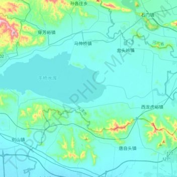
Name: 州河 topographic map, elevation, terrain.
Location: 州河, 蓟州区, 蓟县, 天津市, 301900, 中国 (40.01095 117.43833 40.03709 117.73802)
Average elevation: 197 ft
Minimum elevation: 16 ft
Maximum elevation: 1,821 ft
Other topographic maps
Click on a map to view its topography, its elevation and its terrain.