
勐库镇 topographic map
Interactive map
Click on the map to display elevation.
About this map
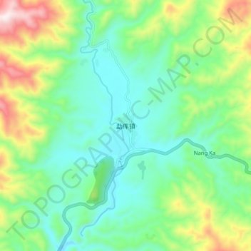
Name: 勐库镇 topographic map, elevation, terrain.
Location: 勐库镇, 临沧市, 云南省, 中国 (23.58020 99.84150 23.66020 99.92150)
Average elevation: 4,144 ft
Minimum elevation: 3,478 ft
Maximum elevation: 5,748 ft
Other topographic maps
Click on a map to view its topography, its elevation and its terrain.