
Chopaka Lake topographic map
Interactive map
Click on the map to display elevation.
Chopaka Lake
Chopaka Lake is a lake in Okanogan County, Washington. It covers an area of approximately 150 acres (0.6 km2), is over 70 ft (21 m) deep at its deepest point, and is 2,910 ft (886 m) in elevation. The lake's name is that of a legendary Okanogan hunter who was transformed to stone by Coyote. It serves as an irrigation reservoir for local ranchers. Chopaka Lake is a favorite among fly fishers who cast for rainbow trout.
About this map
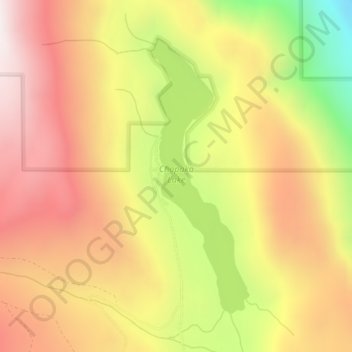
Name: Chopaka Lake topographic map, elevation, terrain.
Location: Chopaka Lake, Okanogan County, Washington, United States (48.90341 -119.70316 48.92460 -119.69144)
Average elevation: 3,386 ft
Minimum elevation: 1,165 ft
Maximum elevation: 4,990 ft
Other topographic maps
Click on a map to view its topography, its elevation and its terrain.
Grand Coulee Dam
United States > Washington > Okanogan County
After power shortages in the Northwest during the 1960s, it was determined the six remaining planned pumps be pump-generators. When energy demand is high, the pump-generators can generate electricity with water from the Banks Lake feeder canal adjacent to the dam at a higher elevation. By 1973, the…
Average elevation: 1,388 ft
Omak
United States > Washington > Okanogan County
Elevations around the area range from 780 feet (240 m) above sea level at the mouth of the Okanogan River to 6,774 feet (2,065 m) above sea level at the Moses Mountain. The average elevation is 843 feet (257 m) above sea level according to the United States Geological Survey (USGS). The Moses Mountain, with a…
Average elevation: 1,194 ft
Tonasket
United States > Washington > Okanogan County
Tonasket is located at 48°42′20″N 119°26′19″W / 48.70556°N 119.43861°W / 48.70556; -119.43861 (48.705626, -119.438568). at an altitude of 1,311 ft (400 m).
Average elevation: 1,122 ft