Geolocate

Todds Point topographic map

Click on the map to display elevation.

About this map

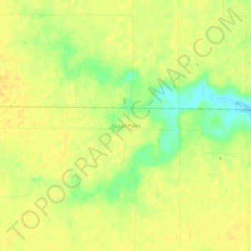
Name: Todds Point topographic map, elevation, terrain.

Location: Todds Point, Shelby County, Illinois, United States (39.55698 -88.78590 39.59698 -88.74590)

Average elevation: 656 ft

Minimum elevation: 597 ft

Maximum elevation: 679 ft

Shelby County trails, hiking, mountain biking, running and outdoor activities

Other topographic maps

Click on a map to view its topography, its elevation and its terrain.

Stewardson

United States > Illinois > Shelby County

Average elevation: 650 ft

Tower Hill

United States > Illinois > Shelby County

Average elevation: 659 ft

Findlay

United States > Illinois > Shelby County

Average elevation: 673 ft

Oconee

United States > Illinois > Shelby County

Average elevation: 676 ft

Moweaqua

United States > Illinois > Shelby County

Average elevation: 620 ft

Cowden

United States > Illinois > Shelby County

Average elevation: 591 ft

Herrick

United States > Illinois > Shelby County

Average elevation: 594 ft

Strasburg

United States > Illinois > Shelby County

Average elevation: 640 ft

Gear up for your next adventure:

😴Insulated Sleeping Pads - Compact and warm pads for high-elevation camping
🛰️Handheld GPS Units - Professional satellite navigators for precise backcountry mapping
🪵Folding Camp Saw - Compact saw for wood and campsite work
🥇GPS Hiking Watch - Multi‑sport GPS watch with navigation and trail tracking
🔋Solar Power Banks - Keep your GPS and phone charged in remote wilderness areas

As an Amazon Associate, this site earns from qualifying purchases at no extra cost to you.