
左权县 topographic map
Interactive map
Click on the map to display elevation.
About this map
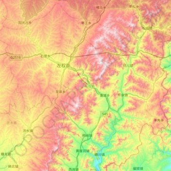
Name: 左权县 topographic map, elevation, terrain.
Location: 左权县, 晋中市, 山西省, 中国 (36.74645 113.09756 37.27579 113.78734)
Average elevation: 4,275 ft
Minimum elevation: 1,962 ft
Maximum elevation: 6,877 ft
Other topographic maps
Click on a map to view its topography, its elevation and its terrain.