
南关镇 topographic map
Interactive map
Click on the map to display elevation.
About this map
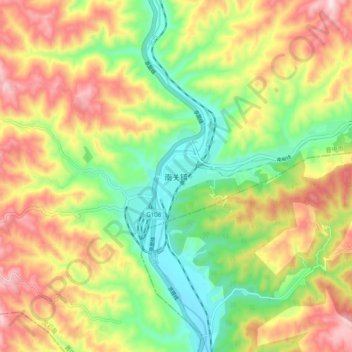
Name: 南关镇 topographic map, elevation, terrain.
Location: 南关镇, 晋中市, 山西省, 中国 (36.66688 111.63446 36.74688 111.71446)
Average elevation: 2,530 ft
Minimum elevation: 1,900 ft
Maximum elevation: 3,287 ft
Other topographic maps
Click on a map to view its topography, its elevation and its terrain.