
太谷区 topographic map
Interactive map
Click on the map to display elevation.
About this map
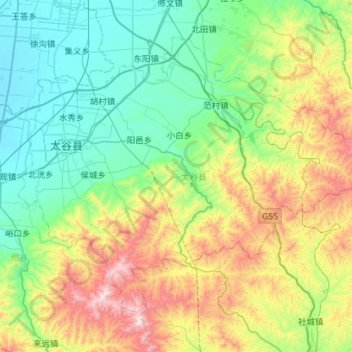
Name: 太谷区 topographic map, elevation, terrain.
Location: 太谷区, 晋中市, 山西省, 中国 (37.20640 112.46652 37.56540 113.03688)
Average elevation: 3,602 ft
Minimum elevation: 2,487 ft
Maximum elevation: 6,562 ft
Other topographic maps
Click on a map to view its topography, its elevation and its terrain.