
巴音塔拉镇 topographic map
Interactive map
Click on the map to display elevation.
About this map
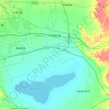
Name: 巴音塔拉镇 topographic map, elevation, terrain.
Location: 巴音塔拉镇, 察哈尔右翼前旗, 乌兰察布市, 内蒙古自治区, 中国 (40.82819 113.08708 41.01174 113.43096)
Average elevation: 4,350 ft
Minimum elevation: 4,137 ft
Maximum elevation: 5,420 ft
Other topographic maps
Click on a map to view its topography, its elevation and its terrain.