
丰镇市 topographic map
Interactive map
Click on the map to display elevation.
About this map
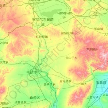
Name: 丰镇市 topographic map, elevation, terrain.
Location: 丰镇市, 乌兰察布市, 内蒙古自治区, 中国 (40.31186 112.79628 40.80428 113.78880)
Average elevation: 4,642 ft
Minimum elevation: 3,360 ft
Maximum elevation: 7,605 ft
Other topographic maps
Click on a map to view its topography, its elevation and its terrain.