Geolocate

Daisy topographic map

Click on the map to display elevation.

About this map

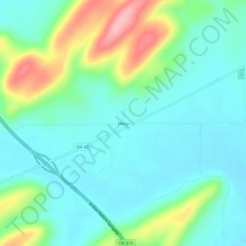
Name: Daisy topographic map, elevation, terrain.

Location: Daisy, Atoka County, Oklahoma, United States (34.51593 -95.75970 34.55593 -95.71970)

Average elevation: 823 ft

Minimum elevation: 696 ft

Maximum elevation: 1,181 ft

Atoka County trails, hiking, mountain biking, running and outdoor activities

Other topographic maps

Click on a map to view its topography, its elevation and its terrain.

Atoka

United States > Oklahoma > Atoka County

Average elevation: 604 ft

Caney

United States > Oklahoma > Atoka County

Average elevation: 554 ft

Tushka

United States > Oklahoma > Atoka County

Average elevation: 617 ft

Stringtown

United States > Oklahoma > Atoka County

Average elevation: 646 ft

Gear up for your next adventure:

🥘Titanium Cookware - Durable, featherlight pots and pans for backpacking
🔭Compact Binoculars - HD vision for scouting terrain and identifying distant landmarks
🧥Waterproof Jacket for Hiking - Breathable and rugged rain jacket for outdoor excursions
🔭Stargazing Telescopes - Perfect for camping in low-light pollution areas shown on maps
🎒Trail Energy Bars - High‑calorie bars for hiking energy

As an Amazon Associate, this site earns from qualifying purchases at no extra cost to you.